Ramani’s Air Operations division carries out all the data acquisition through aerial photography and LiDAR surveys. Ramani owns and operates two (2) aircraft with high endurance, specially adapted for aerial survey operations. The company operates under its own Air Operators Certificate (AOC) using Cessna 182 and Turbo 206T models. Both aircraft are under strict maintenance schedules and are compliant with international aviation requirements for aerial survey. The aerial team consists of two full-time pilots as well as two sensor operators.
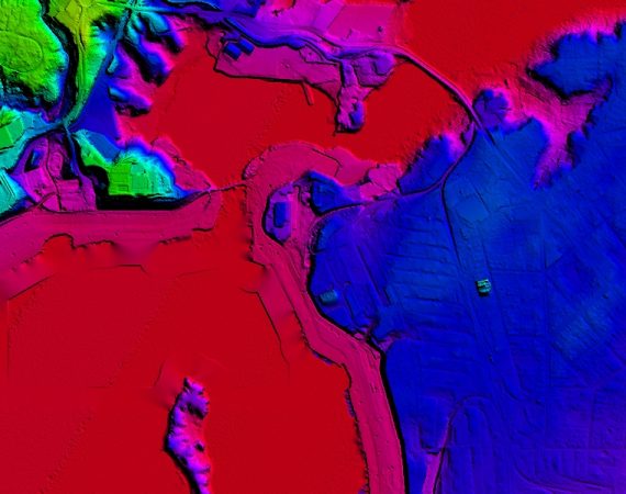
To undertake aerial photography surveys, Ramani owns and operates various sensors including the high-end large format UltraCam X and Phase One aerial cameras. In addition, the integrated Leica ALS60 and RCD30 system gives Ramani leverage to collect high quality photography and airborne LiDAR simultaneously, thereby expediting projects workflows