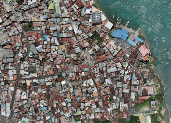
As part of the IUCN-funded Emphasizing Ecosystems, Elevating People (3EP) project, Kounkuey Design Initiative (KDI) engaged Ramani Geosystems Limited to conduct a drone LiDAR and photography survey covering approximately 366 acres of Kibera.
BENEFITS
The survey captured high-resolution aerial imagery and topographical data ahead of planned government demolitions along the 60-metre Ngong River riparian corridor. The outputs supported a participatory planning approach that KDI leads, seeking to reduce climate risk, enhance biodiversity, and demonstrate ecosystem-based adaptation in urban regeneration.
RESULTS/OUTCOMES:
The outcomes included Orthomosaic, 3D models, and detailed maps, provides a baseline for understanding existing infrastructure, drainage, and pollution.